U.S. Roads Face Increased Flood Damage as Billion-Dollar Disasters Quadruple

What's Happening?
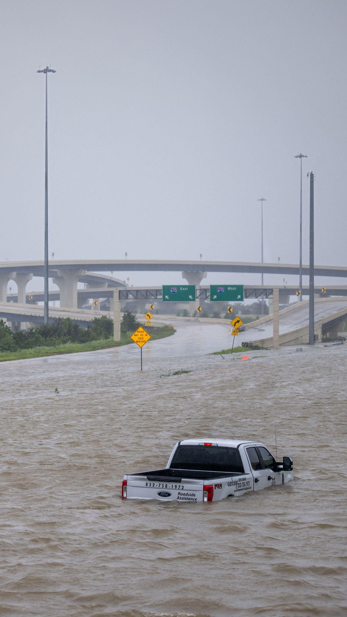
The United States has experienced a fourfold increase in billion-dollar flood disasters over the past two decades compared to the period between 1980 and 2000. This escalating trend poses a significant
risk to the performance and longevity of the nation's road infrastructure. Current pavement design practices often underestimate the damage caused by flooding and standing water, leading to roads failing sooner than anticipated. Researchers at MIT’s Concrete Sustainability Hub (CSHub) are developing advanced modeling tools to identify and assess flood-related damage, aiming to provide transportation agencies with a quantitative risk-assessment framework. This research will offer actionable guidance for pavement design, maintenance policies, and investment decisions in the face of increasing flood risks. The study highlights that visual inspection after a flood doesn't reveal the full extent of damage, as soil beneath the pavement can lose stiffness and strength over weeks or months as it slowly drains, accelerating cracking and rutting.
Why It's Important?
The integrity of U.S. road networks is crucial for mobility, logistics, emergency response, and the overall economy. With approximately 93% of the U.S. paved road network consisting of flexible pavements, understanding and mitigating flood-related damage is essential. Underestimating flood impacts leads to more frequent repairs, shorter service life for roads, and higher lifecycle costs for transportation agencies. The current design standards, such as the Mechanistic-Empirical Pavement Design Guide (MEPDG), do not explicitly incorporate climate inputs related to flooding, particularly short-duration, high-intensity rainfall events that cause ponding. The CSHub research aims to address these gaps by considering the cumulative effects of repeated flooding and providing a more realistic picture of how water infiltrates and moves through a road’s subgrade. This will enable agencies to make more informed decisions, optimize maintenance, and ensure the continued functionality and safety of critical infrastructure.
What's Next?
The research from MIT’s CSHub is expected to provide transportation agencies with a comprehensive framework for evaluating diverse flood scenarios and their impact on pavement performance. This will lead to the development of more flood-aware design and maintenance strategies. Future work may involve integrating machine learning techniques to scale risk assessments across large road networks, further improving planning for maintenance and reconstruction. This will allow agencies to better understand the cumulative impacts of flood exposure and weigh mitigation measures against other funding priorities. The goal is to shift from reactive responses to proactive planning for future flood events, ensuring that investments in road infrastructure are optimized for long-term resilience against changing climate and rainfall patterns.
Beyond the Headlines
The increasing frequency of billion-dollar flood disasters in the U.S. underscores a broader challenge related to climate change and its impact on existing infrastructure. Beyond the immediate economic costs of repairs and replacements, there are significant societal implications, including disruptions to supply chains, hindered emergency services, and reduced public safety. The research highlights the need for a paradigm shift in infrastructure planning, moving beyond historical data to incorporate predictive modeling and climate projections. This also raises questions about the equitable distribution of resources for flood mitigation, as some communities may be more vulnerable due to geographical location or socioeconomic factors. The long-term sustainability of urban and rural development will depend on how effectively these climate-related risks are integrated into policy and engineering practices.