Historic El Niño could bring heavy winter storms

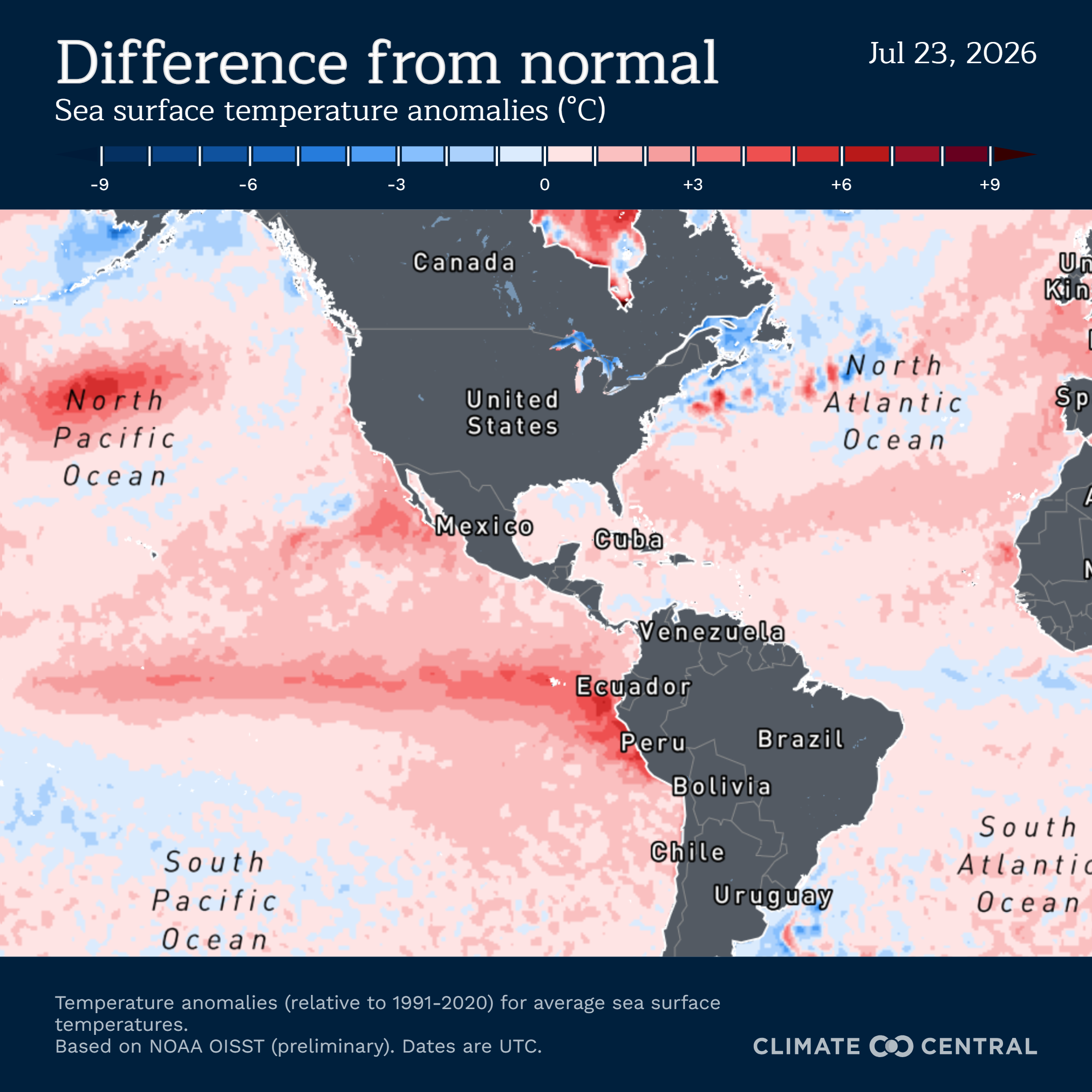
This year's El Niño is shaping up to be the strongest ever, and recent reports suggest its only getting stronger, meaning a higher chance of winter storms for certain Californians.
A report released on
Thursday Sep. 10 by the National Oceanic and Atmospheric Administration's Climate Prediction Center increased the odds of a historically strong El Niño this year — exceeding the "strength of previous El Niño events dating back to 1950" — to 75%.
The center also said there is a "90% chance of a very strong event" during this year's Fall and Winter seasons.
The center had previously reported a 69% chance that El Niño would break records dating back to 1950.
The increased odds of a historic El Niño are a result of continually rising temperatures in the Pacific Ocean.
What is El Niño?
El Niño is a weather phenomenon that occurs every two to seven years.
During El Niño, warm water that typically moves westward towards Asia instead moves eastward towards the Americas. This is a result of weakened trade winds — winds that blow east to west — and the weakening or altogether stopping of upwelling — a process by which cold water from the depths of the ocean is brought to the surface.
The unusually warm waters of El Niño "cause the Pacific jet stream to move south of its neutral position," according to NOAA. This results in particularly dry and warm conditions in the northern U.S. and Canada, and increased rain and flooding in the U.S. Gulf Coast and Southeast.
What does it mean for El Niño to be stronger?
According to Michelle L’Heureux, a physical scientist for the Climate Prediction Center, a stronger El Niño does not necessarily mean more intense weather conditions.
“Stronger El Niño events can only make certain outcomes more likely; they do not guarantee them,” L’Heureux wrote to SFGATE. "... For example, we cannot say that El Niño will lead to more intense rainfall over someone’s house. But we can say that more rainfall, particularly weather events that repeat or recur over the course of a season, can be made more likely by El Niño.”
How will California be impacted by El Niño?
All of California, particularly Southern California, is expected to receive above-average precipitation between October and December.
However, L’Heureux told SFGATE the "strongest probability of increased precipitation" in California is between December and March.
El Niño is also expected to exacerbate the effects of a marine heat wave along California coasts and temporarily increase sea levels and wave energy, boosting threats of erosion and flooding.
El Niño has already been observed to have intensified Hurricane Marie, which didn't reach the mainland but caused high surf across the Southern California coast.
What is the record?
The 2015-2016 Super El Niño remains the strongest recorded since 1950, reaching an Oceanic Niño Index of +2.64 °C in November 2015, according to NOAA.
The Oceanic Niño Index compares a running three-month average of ocean surface temperature to an overall average.